
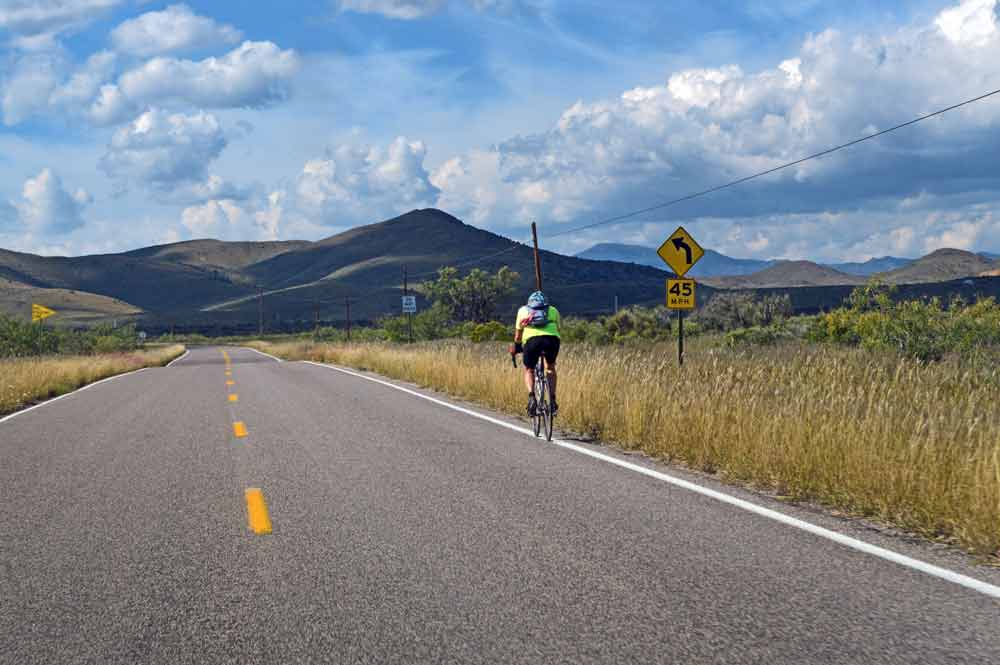
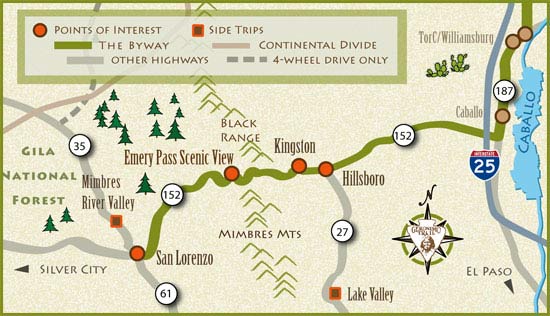
Leaving Caballo, the Byway runs west for about 50 miles on Highway 152, ascending from the Rio Grande Valley through ranch country, over the pine-forested Black Range Mountains through Emory Pass, and then descending toward scrub-dotted slopes. During rare times of severe weather these roads may be closed, and stay closed until cleared.
Hillsboro
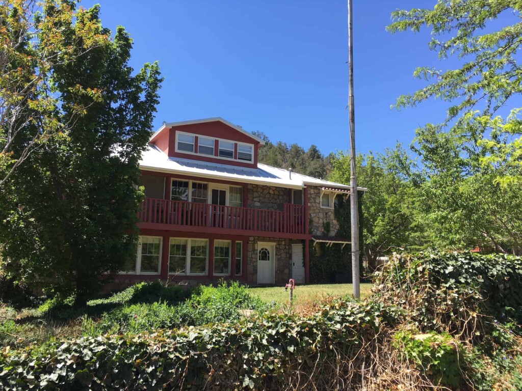
Picturesque Hillsboro was founded in 1877 when gold and silver were discovered nearby. Today it is a well-known community of writers, artists, ranchers and miners. The town’s tree-lined main street features the Black Range Museum (purchased in 2016 by the Hillsboro Historical Society), the 120-year-old General Store (now a restaurant), lodging accommodations, shops, and artist’s studios.
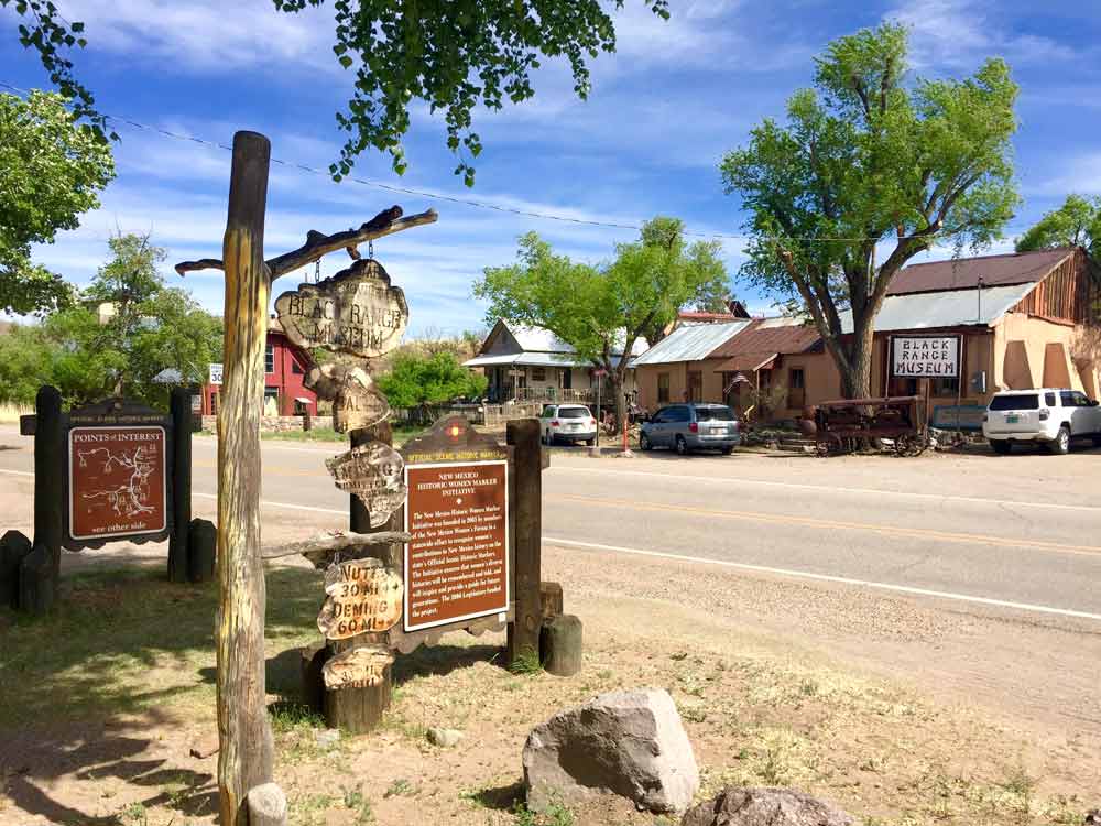
The Hillsboro Community Center sponsors regular, high-quality musical events throughout the year.
SIDE TRIP FROM HILLSBORO
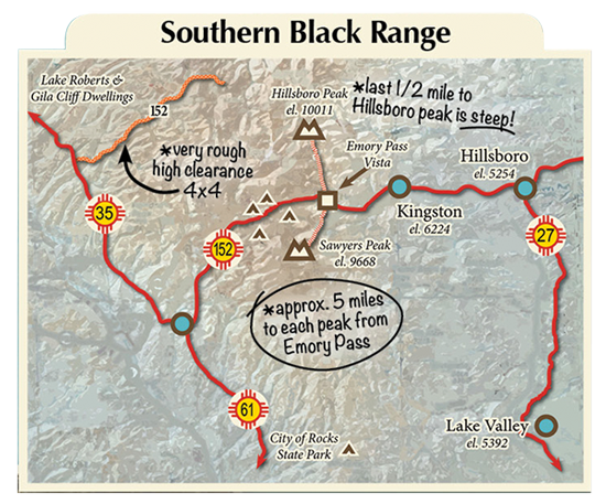
Lake Valley
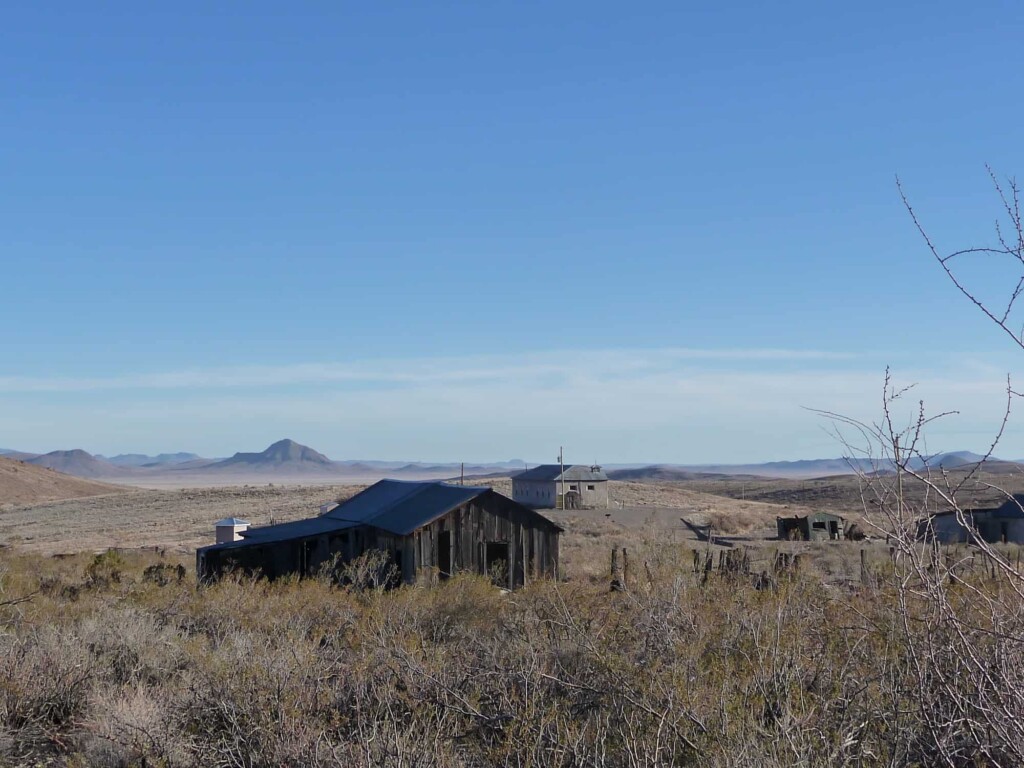
From Hillsboro you can take a side trip to Lake Valley, a ghost town about 18 miles south. Named in 1878 for ancient lake beds nearby, this silver mining town had a heyday population of over 4000 people. Today Lake Valley is cared for by the Bureau of Land Management, and remains fairly intact. Weathered wooden buildings, a school, a garage and several houses still survive. This was the location of the Bridal Chamber Mine, one of the richest veins of silver ever discovered.

Kingston
As NM 152 winds up into the mountains, it passes Kingston, another 1880s mining town with a reputation for wild and wooly ways. The Percha Bank has been restored but is currently closed; the Kingston Schoolhouse Museum is open by appointment: 575-895-5501.
The Black Range Lodge is an ideal spot for a personal or group retreat. The lodge hosts Pickamania, 3 days of regional folk music, at their Pavilion every year in mid-September.
Kingston’s Historic District features several buildings and the town bell, cast from ore from local mines. The old cemetery outside of town is still in use, and is a nice place to visit if historic grave markers are your thing.
Emory Pass
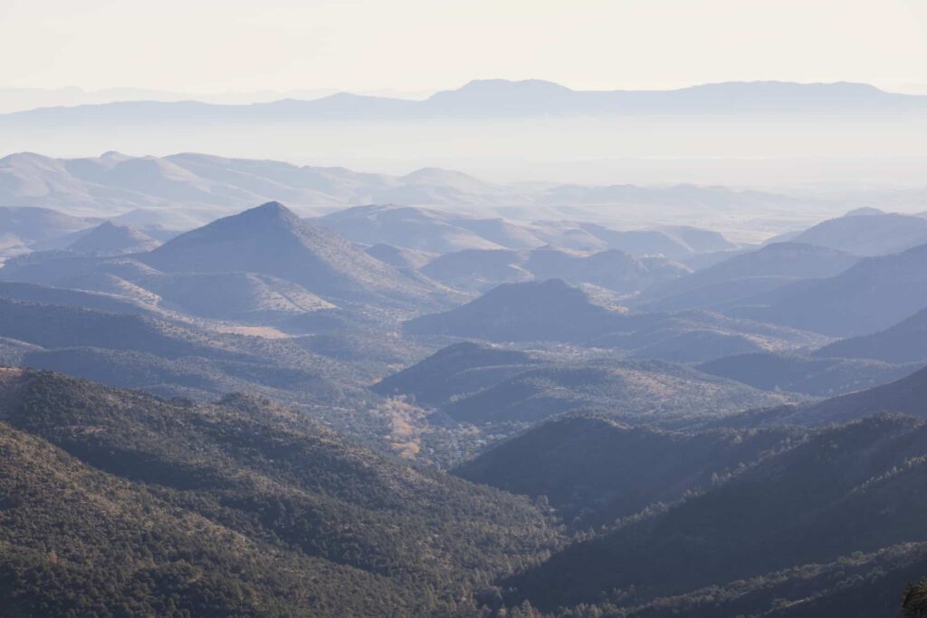
Continuing west past Kingston, the road gains nearly 3000 feet in altitude over nine miles, and crests at Emory Pass. This magnificent viewpoint at above 8,000 feet overlooks mountains, valleys and Caballo Lake over 50 miles to the east. An extensive system of trails offers pleasant hikes through cool forested mountains or along shady streams. Backpackers will find plenty of beautiful, wild, rugged, and remote country for long trips in quiet solitude.
San Lorenzo
Leaving Emory Pass, the terrain changes from towering pines on the mountains and cliffs overshadowing the road to gentle slopes, with juniper, cedar and scrub oak, until it reaches the Mimbres River Valley.
The Geronimo Trail National Scenic Byway ends at the junction of NM 152 & NM 35, just south of San Lorenzo. Turn north toward San Lorenzo on NM 35 to access the adjoining scenic trail, the Trail of the Mountain Spirits National Scenic Byway.
Comments are closed.